

Springer Mountain to Woody Gap (AT Mile 0-20)
Type: Overnight
Total Mileage: 22.42
AT Direction: Northbound
AT Miles: 0-20.2

A long week in the office called for a weekend in the backcountry. Originally intending to start at the Approach Trail and end at Woody Gap, the trip was shortened to start at Springer Mountain to make the shuttle work as well as the time I wanted to hit the trail. Looking back, it was the better decision.
The trip started in the fog at Woody Gap. Driving up the mountain, you could just see the ridgelines in the distance with clouds still settling in the valleys. After getting picked up by Ron at 7:30, we were off to Dahlonega to pick up a couple of people day hiking and onward to Springer. We approached from the Winding Stair Gap side and I would agree with recommendations that this side requires a 4WD or AWD vehicle with decent ground clearance. If you are trying to take a car up to this trailhead, I would recommend approaching from the Doublehead Gap side though please remember these are forest service roads.

Summit of Springer Mountain
Arriving at Springer Mountain trailhead at 8:45, I headed the .9 miles southbound to tag the terminus before heading northbound. While the mountain was still encased in cloud, it was starting to burn off some. Touching the first blaze, I couldn’t help but wonder what it would be like to keep heading north to Maine instead of knowing I would be getting off the trail the next day. I didn’t spend a ton of time on the summit since I have done the Springer to Hawk Mountain section before in different trips and knowing that I had a pretty long day ahead of me. Facing north, it was officially time again to start ticking miles off.

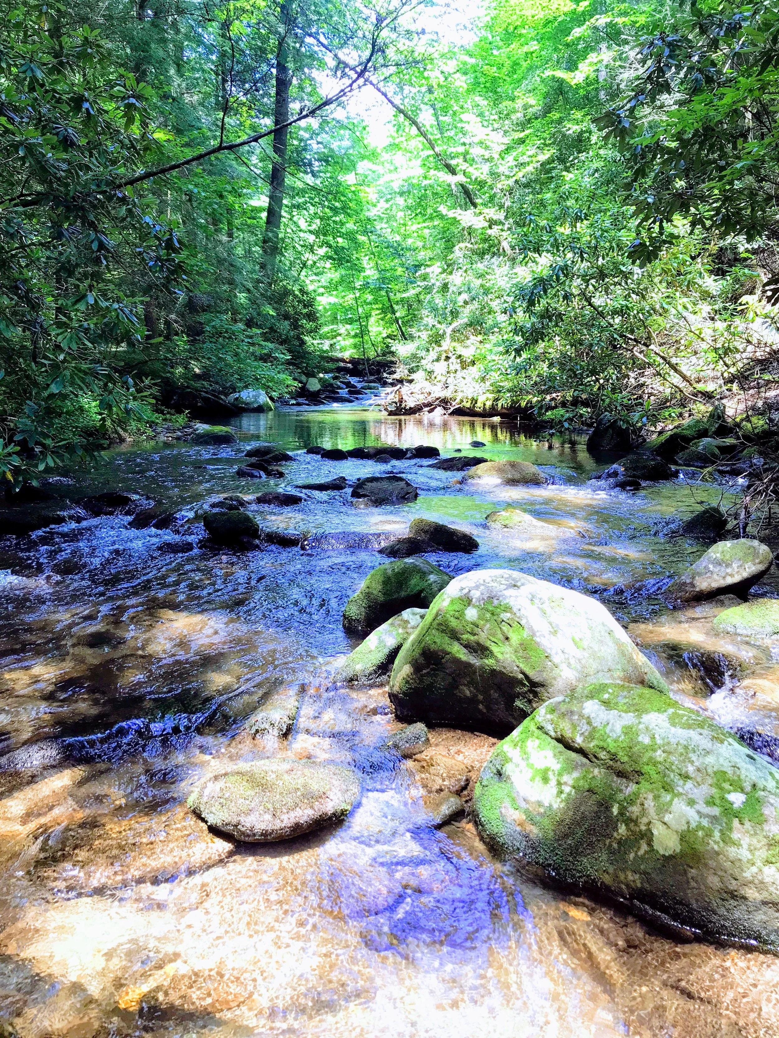
Arriving at Three Forks
The first four miles are deceptively easy and pretty much all descending. You cross paths with the Benton Mackaye Trail (BMT) twice in this section (it shares the southern terminus with the AT). Just before Three Forks, the BMT joins the AT for the next mile before parting ways just past the side trail to Long Creek Falls. They will not connect again until the Great Smoky Mountains. Three Forks is also a popular trailhead for day hikers and weekend car campers. Long Creek Falls is just a mile from the trailhead and there are plenty of places along the forest service road to setup a car camp or hike a small distance up the trail to find a spot. You may want to plan accordingly if this is your camp after a long day. From Three Forks, it is uphill all the way to Hawk Mountain. Be sure to take the side trail to Long Creek Falls for a nice break - it was a great place to stop and filter some water in the cooler air caused by the waterfall. During the late winter / spring, there are small streams that cross the trail on the way up Hawk but as it was the heat of summer, almost all of them had dried up so I was glad to fill up before I started the climb. There is a spring at the campsite just before Hawk Mountain Shelter - be warned that it is downhill almost a half mile from the AT so if you can wait, just fill up at the shelter.
Back in the shuttle in the morning, Ron and I had discussed the storm forecast and water conditions on the trail. As is typical with Georgia, we were scheduled to get our first fast moving thunderstorm at 1:00 pm. While climbing Hawk, I could hear the thunder in the distance but was holding off. At 12:40, I turned off onto the side trail down to the shelter. After making a stop at the pivy, I dropped my pack off at the shelter and headed down to the stream to grab water. Hawk Mountain Shelter is the last reliable water until Justus Creek which is six miles down the trail so I wanted to make sure to get plenty to fill up at the shelter and have two liters for the trail. At 1:00, like clockwork, the storm hit and the bottom opened up on the clouds. I was happy to be sitting inside the shelter when it happened.

Just beat the rain
Five minutes later, a father / son pair I had leap frogged a couple of times came down the side trail completely soaked. They had also hiked from Springer - they had gotten dropped at the trailhead while I was coming down the mountain. I don’t know why they didn’t summit the mountain being that close but to each their own. They were stopping at Hawk for the day so we had a brief discussion while it rained and I had lunch. They were out for the next nine days and were probably trying to make the NC border. It was the father’s first backpacking trip so a seven mile day wasn’t too bad. The son was a Boy Scout was he was accustomed to this activity. After a half hour, the rain had stopped and I was read to hit the trail again rehydrated and fueled up. I had at least six more miles to go before I could make camp and was ideally targeting Gouch Mountain Shelter which was eight miles away from Hawk. So with the sun out and some thunder in the distance, I set out again.

A little bit of a view from Sassafras
If you have ever done any hiking on the Appalachian Trail, you are probably familiar with PUDs. For those not, a PUD is a `Pointless Up and Down` and it is when the trail seems to find every hill or mountain for no reason at all. It is often said on the AT if you see the highest point near the trail, there is a pretty good chance that you are going to go over it. These climbs do not necessarily need to be long in distance or very tall - it is the consistent steep up and down followed in rapid succession by another steep up and down that came zap your will and energy. There are two of these PUDs between Hightower Gap and Cooper Gap with one being some unnamed hill and one being Sassafras Mountain. After climbing the PUDs in the heat of the day, I was happy to make it to Cooper Gap and onward to Justus Creek. This section was a slow climb and then a long downhill toward the creek. When I was a quarter mile away from the creek, I looked toward the downward side of the trail and saw my first black bear while on the trail. Immediately, I could feel my adrenaline hit me. It was probably a few hundred yards off the trail and really wasn’t concern with me. I yelled “Hey Bear” and click my trekking poles together to make sure he knew where I was and see if he would turn and run which he didn’t.

Watching from that bear at Justus Creek while getting water

Gouch Mountain Shelter
Seeing that he wasn’t that interested in me, I slowly continued down the trail looking over my shoulder to make sure he wasn’t following me. Descending the steps to Justus Creek, I knew I needed to stop and filter some water as this was my first source since Hawk Mountain six miles back. Given that the thunderstorm was still rumbling more and more and I had just seen the bear, I decided to grab only a liter and move on toward the shelter. I didn’t like being a stationary target for the bear while filtering water and worried that he might cross the creek and be uphill of me now. In all honest, I knew this wasn’t likely at the time but I can’t stop my mind from running through possible scenarios. With enough water for the next mile and a half and the storm growing, it was time to push for Gouch Mountain Shelter.
After a couple close lightning strikes and it being 5:00 pm, I turned off toward the shelter just before the rain started - that was twice I had dodged getting wet today. There was another father / son pair in the loft of the shelter - they had came from Hawk Shelter that day and stopped around 1 pm when they made it to this shelter. With it raining and highly likely to rain most of the night, I setup my sleeping pad on the lower platform of the shelter and started to unpack items for the night. I’d wait till the rain slowed or stopped to get water and cook dinner; I had enough water to rehydrate and recover from the day’s hike. It was time to just stretch out and relax to the rain. About an hour later, it had stopped enough to continued with my camp chores and by 8:00pm, I was tucking into bed for my first night in a shelter.
Now shelters are perfect homes for mice - easy place to make a home, a ready source of food crumbs from hikers. I knew this fact setting up in the shelter that night but I tried push it from my thoughts. Waking up around 10:00 pm, I thought I could hear the sound of little feet and scratching. Again, I tried to block the image my mind was painting but the damage was done. Even if it wasn’t true, my mind would turn every noise I heard during the night into a mouse that was coming to crawl on me. Grabbing my head lamp and tent, I went to setup on the tent on the pad about 200 feet from shelter. In short order, I had transferred everything to my tent and proceeded to resume my night. I don’t know why but the thin sheet of Dyneema between me and the world brings a sense of comfort. Adding to that an audio book, I was able to sleep the rest of the night with the usual tosses and turns to stay comfortable.

Thick tree cover blocking side slop views

View from Ramrock Mountain
In the morning, I was happy to know that I hadn’t disturbed the people in the loft by my late night relocation. Within an hour and half, I had broken camp, had breakfast, and completed my morning camp chores and was ready to set off by 8:00 am. The father / son pair set off 15 minutes before me but I knew I would pass them on the trail later on. Gouch Mountain wasn’t bad climb for being right out of the gate; however, the trail at Gouch Gap has recently been rerouted so it took a little bit of looking to make sure I was on the right path. The trail remained side slope for a little while - I’m sure during the winter or late fall that there would be amazing views to be had. With summer, the trees were in full leaf out so most of the views were blocked. Shortly, the two real climbs of the day started - these were both part of Ramrock Mountain. Though a little steep, both were rewarded with great views from their summits with good overlooks. Having finished Ramrock, it was only another mile and half back to the car with no real climbing left. Popping out into the Woody Gap parking lot, I was happy to see the car still there.
Having completed another twenty mile section of the AT, I’m planning my next two sectiosn that would connect me to the miles I did around Standing Indian Mountain. I think both are either going to be two and a half or three day sections from Woody Gap to Unicoi Gap and from Unicoi Gap to Deep Gap. This final section will complete the GA section of the trail for me. I’m hoping to complete these sections in 2019 and pick back up with mile 103 and push north in 2020.


