
Neel Gap to Jarrod Gap (AT Mile 26-31)
Type: Day (Out and Back)
Total Mileage: 10
AT Direction: Southbound
AT Miles: 26.2-31.3
After a busy January, it was time to get some trail miles in. Knowing that thru hiking season was soon to start (I’m sure there were people already on the trail for the year), it made sense to finish this section before I pushed north again later in the year and be prepared for a small break from the AT until the bubble passes by. With the weather starting below freezing and the promise of a mostly sunny day, it sounded like a perfect day for a hike.
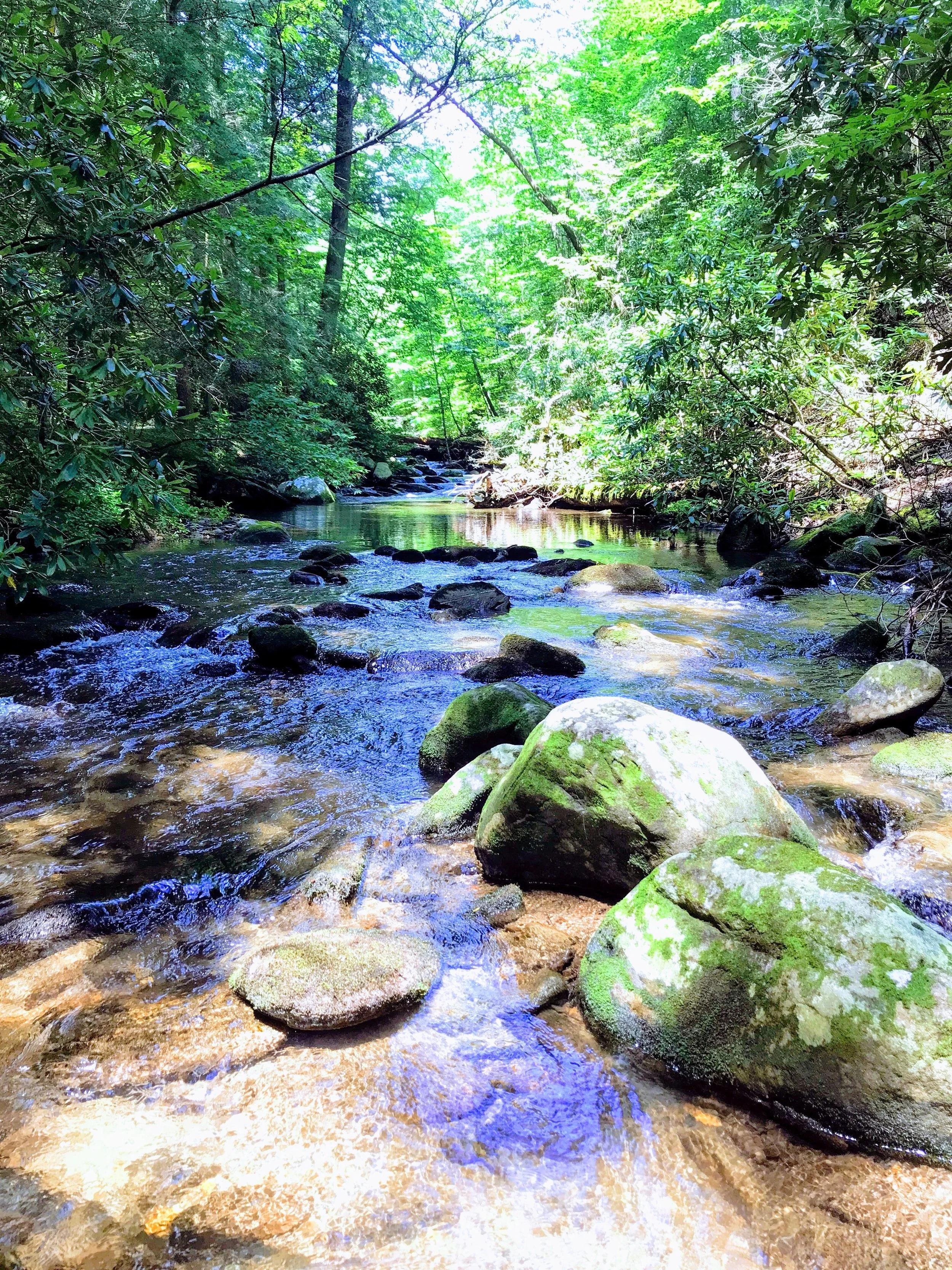
First light through the trees
After my last trip and missing sunrise, I wanted to try to make it to the summit of Blood Mountain around sunrise this time. Pulling into the Byron Reece trailhead parking lot a little after 6 am, I started the night hike up the connector trail to join the AT. I can remember the first time that I night hiked and the completely different feeling that the forest takes when you can’t beyond the reach of your head lamp. It is a slightly unnerving feeling that you eventually just get used to. After a mild climb and .7 miles, I saw the first white blaze of the day and headed south to continue the climb up Blood Mountain.
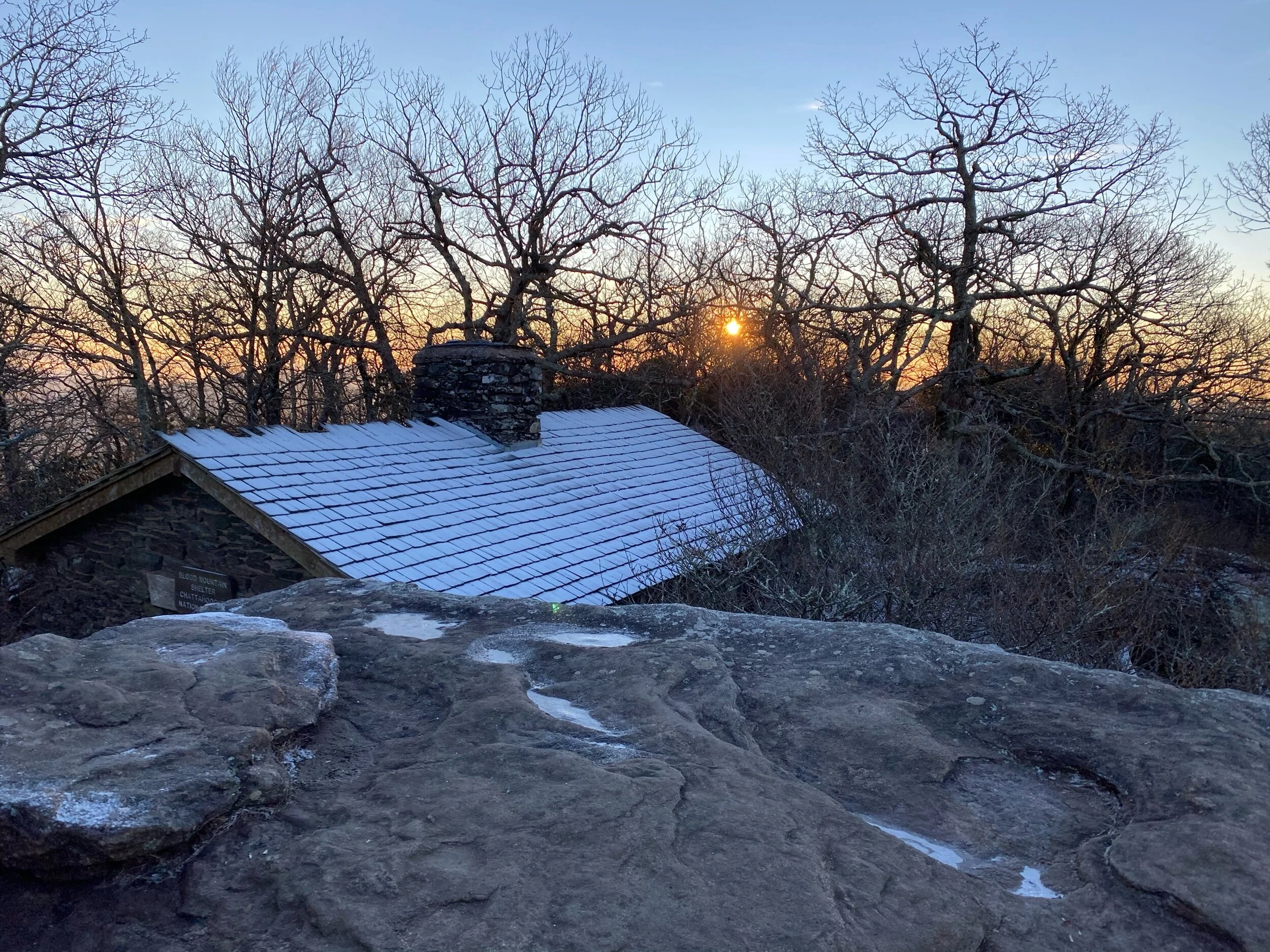
Sunrise and Snow
I had heard that the descent from Blood Mountain when going north was the worse part of Blood Mountain - it was supposed to be steep in places and long. With this knowledge, I knew I would be doing this in as a climb which would make it slightly worse. I was glad to be starting with it and to be doing it as the sun was rising so I could enjoy the changes in the light as I grinded up the mountain. The middle section of the climb was moderate with several step ups; after that, the climb became easier as I got higher. To my surprise, there was snow on the ground which only added to the magic of an early morning hike.
Summit
Blood Mountain Shelter
The sun had just finished becoming fully visible as I reached the summit and took a moment to grab a quick panorama photo of the land bathed in orange. A little bit further was the Blood Mountain Shelter. It is one of the iconic shelters on the AT, especially in the Georgia section. Its stone construction is completely at home on this rocky summit; its open windows and position would make it a cold respite to spend the night in during the cooler months. This would explain why the people who decided to spend the night up there that night had set up their tents inside the shelter. In my mind, this is a jerk move; it takes up the entire shelter so anyone that might have planned to stay there would have been rooted out. This conclusion was further enforced by their hanging household trash bag on the summit sign - this area of trail is generally under a bear canister requirement so not only were they not practicing Leave No Trace, it was potentially dangerous to them. I snapped a couple quick pictures from the rocks next to the shelter and moved on down the trail. I would get to meet the tent in shelter dwellers later in the day.
Duncan Ridge Trail
The descent down the south side of the mountain was gradual with more snow. Part way down I met the intersection of the Duncan Ridge trail which takes hikers back toward Slaughter Mountain and the Coosa Backcountry trail which I have mentioned in previous posts. This is also an intersection where the Georgia Loop breaks from the AT and joins the Duncan Ridge trail until it connects with the Benton Mackaye Trail and ultimately rejoins the AT back near Three Forks at Long Creek Falls. It is considered one of the hardest hikes in Georgia and I hope to do it someday. Further down the trail, I passed Slaughter Creek which would be a great place to fill up on water instead of having to make the trip down to Woods Hole Shelter if you are heading southbound or before starting the accent up Blood Mountain northbound. Soon, I reached Jarrad Gap which would be my turn around point for the day and started north once again.
As I approached the summit of Blood Mountain once again, the sun had brought the day hikers out and a few had already made their way to the top and were milling about. The tent campers had moved on (thankfully having taken their trash). The snow was still holding on in the shade; however, the north side of the summit has already melted. With the sun now up, it was time for a quick layer swap before continuing the descent toward Neel Gap.
Having already covered this section of trail, I kicked it into high gear, pausing to allow the ascending day hikers to continue their climb, providing encouragement when I could, and enjoying the sunshine and the descent which is so much less cardio impacting. At the halfway point, I finally met up with the shelter tenters (all 12 of them). I could tell this by 1) their packs were strapped to the gills with stuff 2) the 70 qt cooler that they were now lugging down the mountain and 3) their general lack of any trail etiquette by blocking the trail while they adjust their packs, rested from lugging the cooler and just didn’t care about the other hikers that needed to get past them.
I’m all for equal use of a trail. I don’t believe I’m better than others. What I don’t enjoy is the lack of trail etiquette. For me, trail etiquette is
People on ascent have right of way (see LNT)
Move to the side of the trail if you are taking a break - which means taking them where this is possible (see LNT)
Music in headphones only (see LNT)
Don’t hike in crazy big groups (see LNT)
It is fairly common in high usage areas for people not to observe these practices. Once while backpacking the Panther Creek trail, I watched two school buses drop 70+ students for a day hike to the falls. I was baffled by the lack of respect for the trail and those using it. Ultimately, I try to find lesser used trails or get out early before crowds appear.
Passing this group, I continued on the AT passed where I had joined it in the morning. Next stop was Mountain Crossing at Neel Gap. For those that thru hike the trail, this is the first major stop along the way to resupply, change gear, and stay at a hostel. I had always imagined what it would be like to pop out of the woods northbound on the AT and see the tree with all the shoes hanging in it. Even though I was only on a day hiker, I still had that feeling when I saw the Mountain Crossing sign and the tree on those last few steps on the tree. This marked the end of today’s journey and connected my footsteps from Springer Mountain to Neel Gap. After a quick shop at the outfitter, it was time for a quarter mile road walk back to the car at the trailhead.
Tree full of shoes

